 Still Thursday, July 17.
As we left the logging roads that led us to Eggcellent, we headed north for another set of logging roads some 240 miles away in the panhandle. We took Elk River Road to Highway 3, a rural highway that cut north through more typical Idaho scenery: stubby brown hillsides, hay fields, farms, and roads that disappeared around the bends only to pick back up again.
We had a music crisis that had reached critical mass around this time, two weeks into the road. I had this idea that we were all going to take turns with our music. It turned out that Jason completely forgot about this idea…forgot about music completely actually, and didn’t have a single audio file loaded on his phone except two odd voice mails that we actually did listen to in our desperateness. I never thought I would see the day, but after twenty two years as a fan, I finally burned myself out on the Indigo Girls during this trip. I couldn’t handle my own music anymore, I was so over it, despite the bonus albums I had borrowed from the library to burn copies of (apparently all “hippy dippy shit”, according to Jason). We were listening to some of that this day – some odd Peter, Paul and Mary tracks that I had never really heard – but finally we had to kill that off and go for the one thing that kept us from driving each other crazy three weeks on the road – the audio book of the first Game of Thrones story, “A Song of Ice and Fire”. At thirty three hours long, it was the perfect road companion. We listened to this for a couple hours at a time almost every day of our trip this summer, and finally finished it off on the last stretch of road from Dallas to Houston.
We were starting to get hungry, but we didn’t drive through any real towns for quite a while on this stretch. Finally, around two pm, we reached Saint Maries, a little town that was apparently the site of a “Wobblies War” between unions and state/federal forces. Across the street from the historical marker describing this (also a virtual cache), we found respite in Bud’s Drive In, a greasy spoon offering great burgers and cool drinks. We had the friendliest waitress ever, who insisted on making us “Arnold Palmers” when we couldn’t decide if we wanted lemonade or iced tea, and insisted on making us to-go cups of it as we were leaving (even if I wasn’t quite convinced I liked it – it was really hard to say no to her enthusiastic spirit).
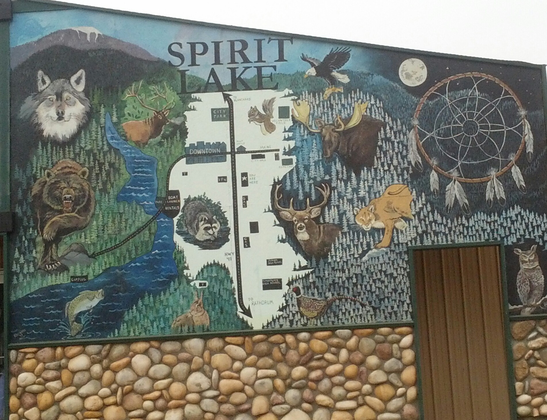
Speaking of spirit, pretty soon we were passing through Coeur D’Alene, then out into the watery and less inhabited regions of Idaho. This sign made me want to stop and stay a while at this place, but we were on a mission. Maybe next time.
 We were heading north to Priest Lake State park, a campground just thirty miles from the Canadian border. The reason we were headed there was because this time, this year, I was going to find this particular “grandfather” cache: Camels Prairie Stash, which is hidden off the logging roads basically across the road from the park.
This is the oldest cache in Idaho, having a hide date of 6/17/2000. It has been found a little bit more often than the other ones we found on this day (about 150 times by the time we found it), despite the challenges in getting to it, and is owned by Moun10Bike, who is a Charter Member and legend in the geocaching world.
Mostly, I was in it for the view. I wanted to experience this exact moment that is in this picture from the cache page (not my pic). I love this picture:
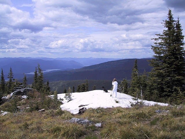
This picture just seems to sum up what it is I am after in our adventures into the wild.
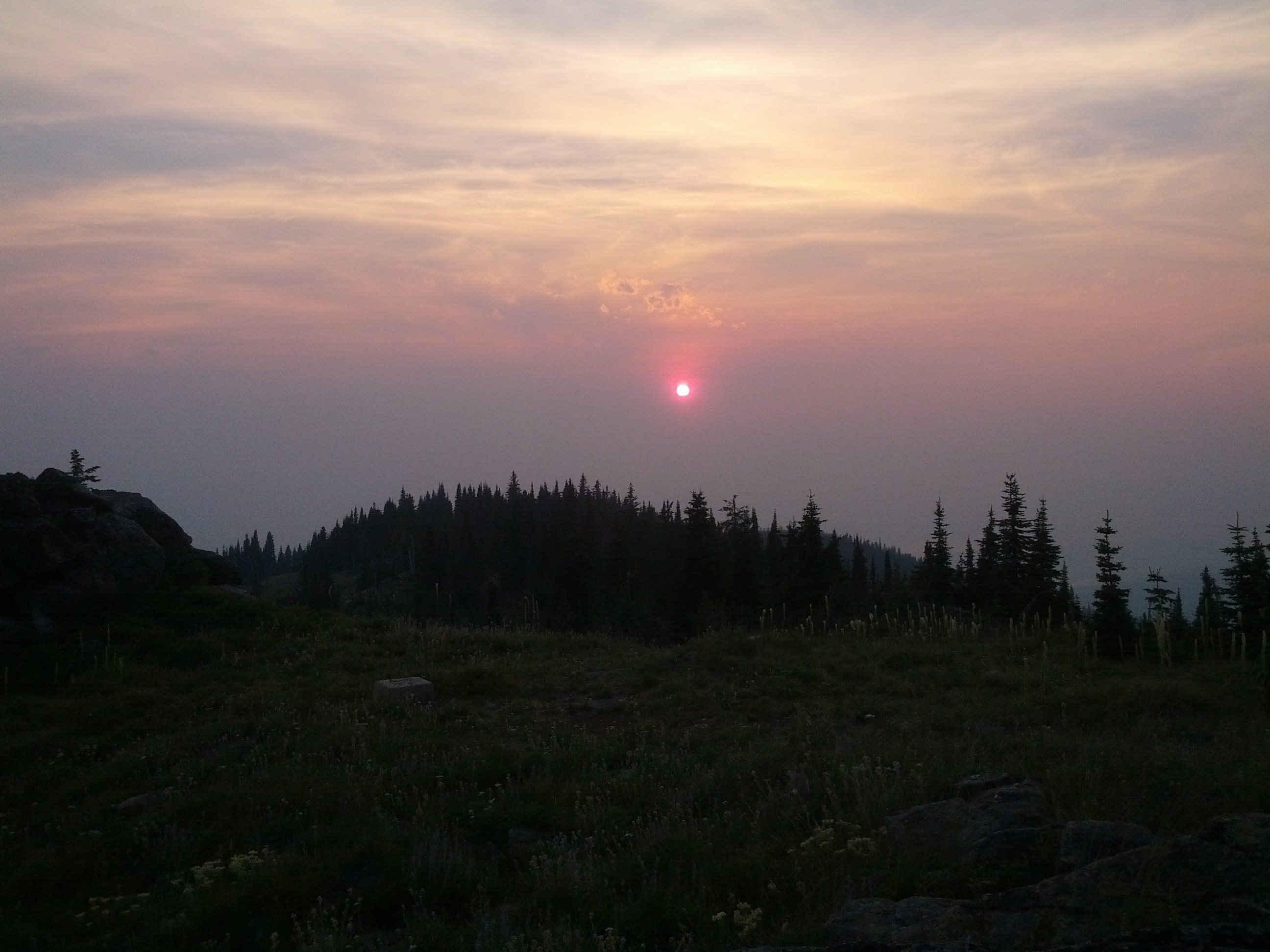
As I learned, it was not the right time of year for this photo…nor am I sure I want to actually be here when there is snow still on the ground. The way to this area was rough, and I felt a little more vulnerable out here than I anticipated (might have had something to do with the fresh bear scat we saw, and that others reported seeing in their logs). So we didn’t get THAT picture, but we did get this one, which I was happy with: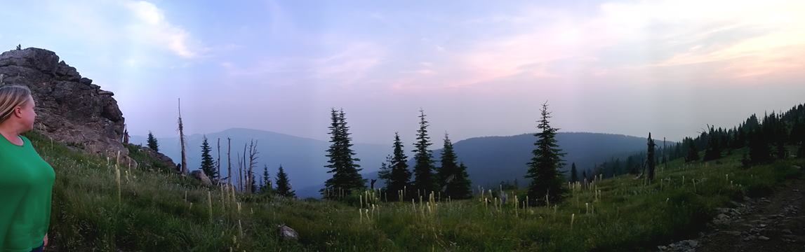
I wasn’t sure we were actually going to make the find on this one, to tell you the truth; at least not during this first evening’s attempt. It was a bit tricky to get to. When you look at a map of the area, you see little tendrils reaching out from the main road, indicated the various logging roads, but internet maps are not up to date with the changes these roads taken over seasons or years. Places that showed up as roads on the map were barricaded by gates, so overgrown beyond that to the point of being impassable even if the gates were open. Previous finders indicated the way was challenging, but did not leave hints on how to actually navigate these roads. It was like some conspiracy, one finder wrote, to leave out the critical information of the journey.
The ridiculous part about our attempt to get there was that I had already actually researched our approach, and came up with two “markers” in the way of other geocache hides that would indicate where the turns were that we needed to make. Jason took a look at the area, though, when we got there, and didn’t agree with my assessment. He is usually right, so I trusted him…but then we spent over an hour traversing a logging road that ended up taking us in the other direction, and we were running out of daylight. We decided we were going to have to give up for the night, but on the way out, we were both like, “but wait, what lies this way?” and took a left instead of the right that we would need to take to get out. After this, we ended up finding the way to those hides I had marked on the GPS unit, which took us right up to the turns we needed to make.
The last stretch of road was an uphill climb of about a mile and a quarter. The cache owner advised leaving the vehicle at the bottom of this hill unless you had a 4×4 vehicle, but Jason thought we could make it in the Subaru, and we were running out of daylight. I suspect that this road has changed in the fourteen years since this cache was hidden, though. There were deep ruts, like hills, that kept scraping the bottom of the vehicle as we went over them. We took some video of this as well, and hopefully I can find where Jason stored them soon. The videos got a little tense, though, and you could hear me cussing a little and telling him that maybe we should just stop, now. This was one of those rare instances where Jason is a lot more reckless than I wanted to be. I started making a plan for how we would deal with it if we ruined our vehicle and got stuck out here. In the end, he did finally stop the car, about 0.43 miles from the cache, and admitted he probably should have stopped it sooner. We were lucky in that all it cost us was a dented muffler and some “trail badges” of scraped paint. 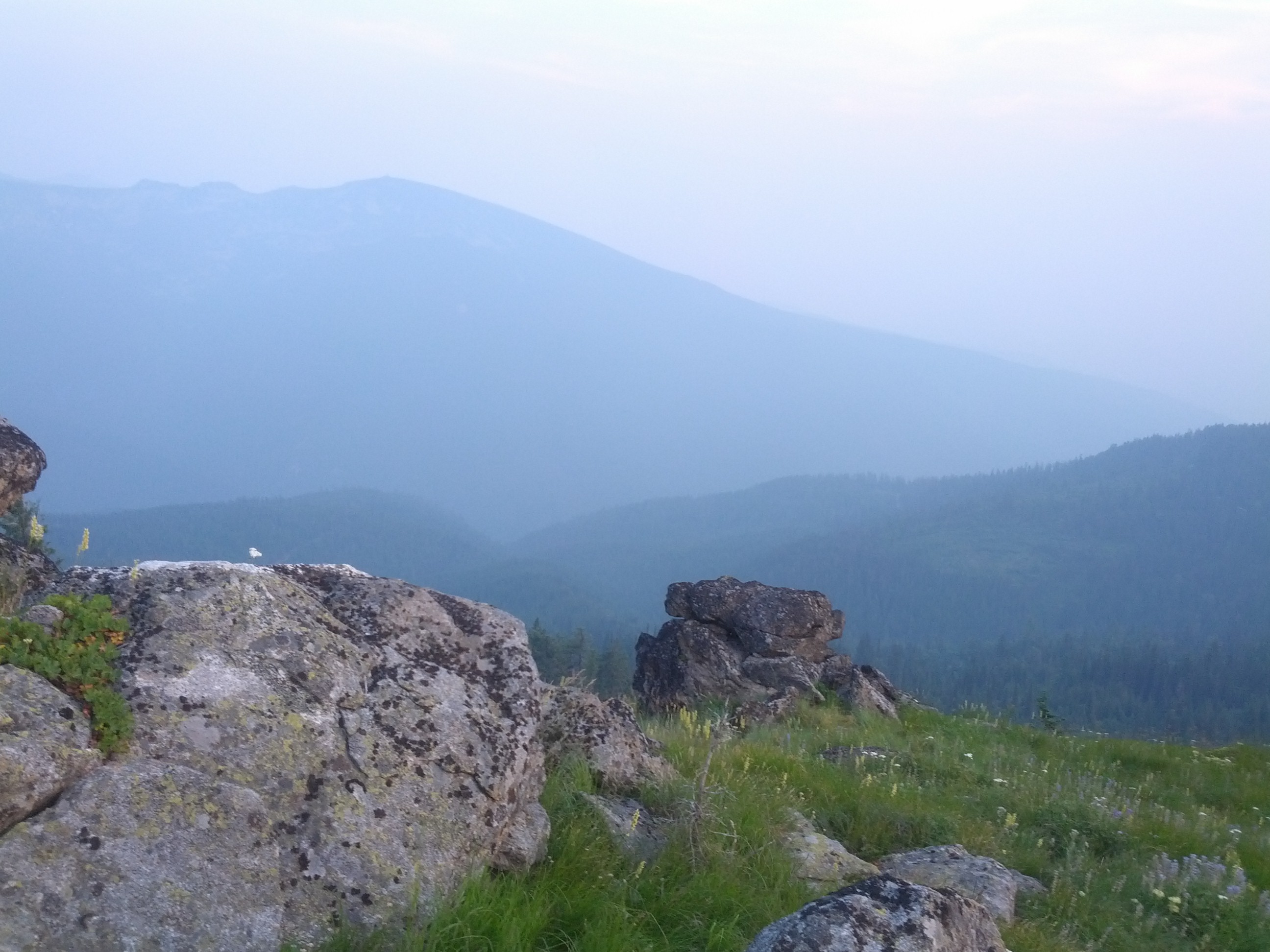
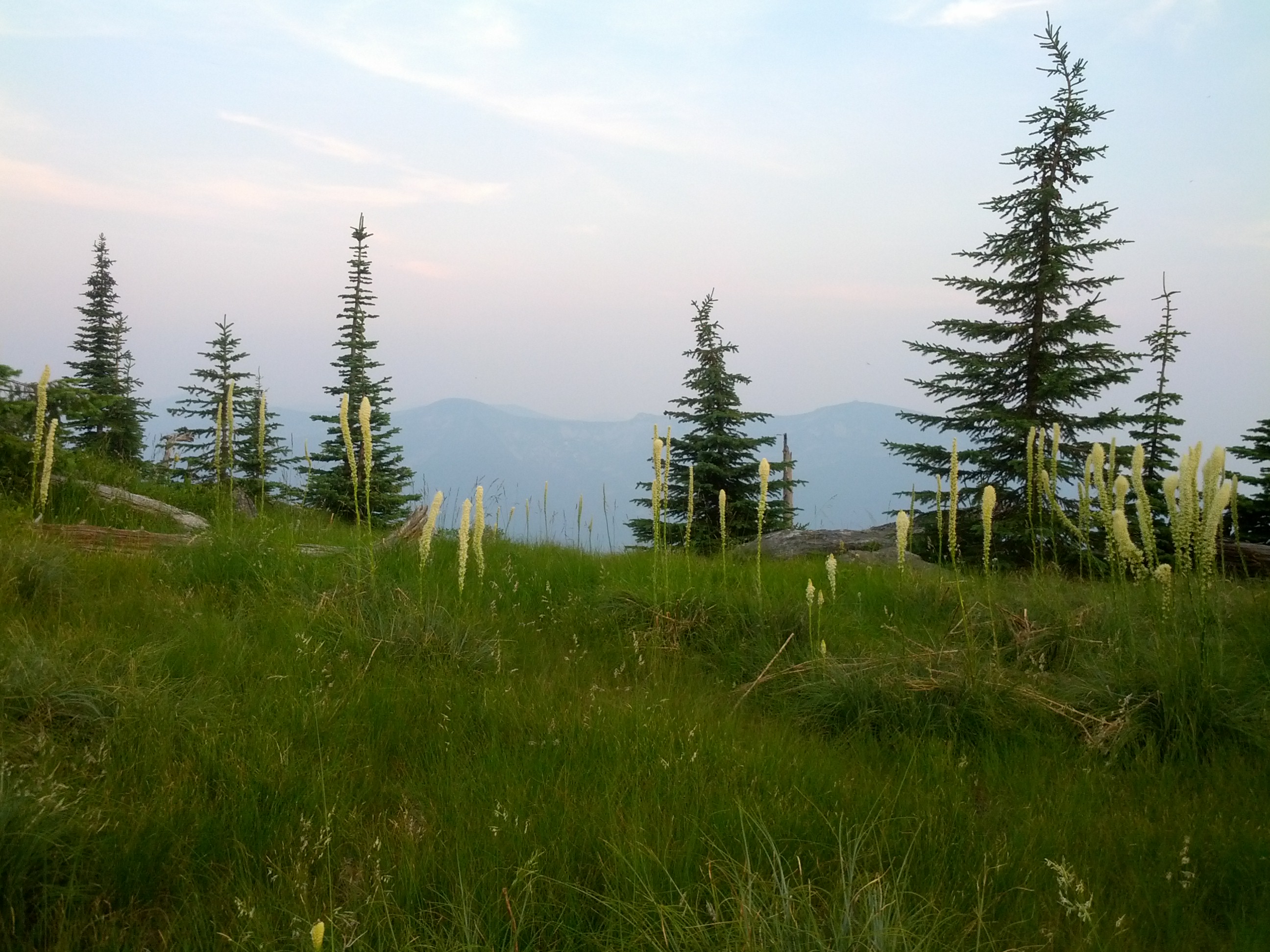
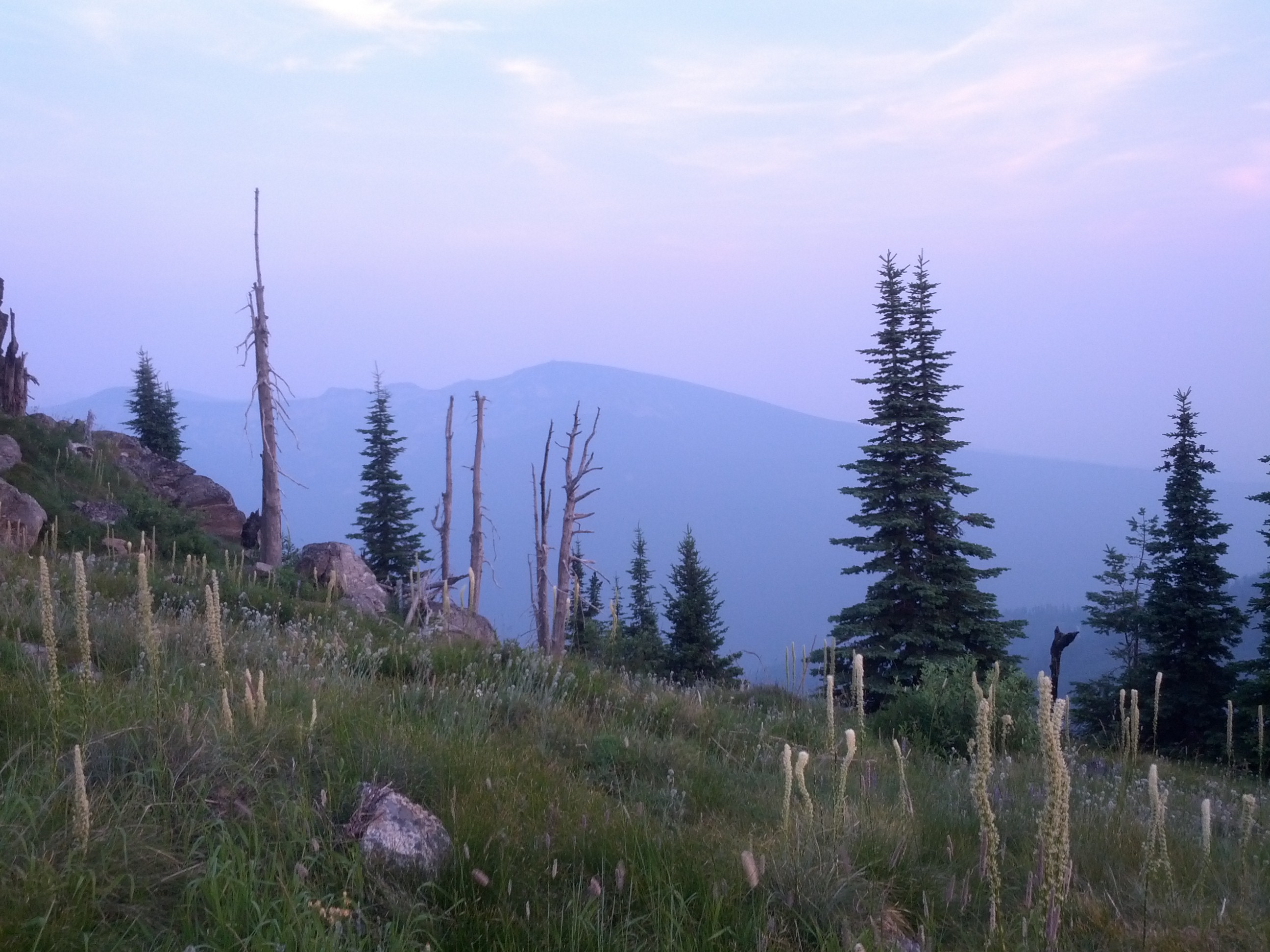
We walked up the rest of the hill as quickly as we could, not wanting to get caught out here after dark. The entire time, I had the sense that there were animals out here watching us, but we didn’t see any. We took some photos, but not as many as I wanted, and did look out at the mountain/hills in the distance from look out points, but we didn’t waste a lot of time, and made a quick scramble back down the hill to the Subbie. I was amazed that we actually made the find after all that difficulty getting there, and it was really beautiful up there. Would do it again in a heartbeat.
We made camp late in the night. Still needing to come up with some dinner, I warmed up the remainder of the pasta I had made in Pocatello, and we scarfed it down in the darkness. I had to clean out the cooler at this part of the journey, and we walked to the dumpster under a night bright with stars and anticipation. Every once in a while when we are camping in the northwestern states, I have the feeling like I did at this place, like the world is so big and we are so small, and those stars just keep blinking under a sky that seems so much closer and the air so much sharper than it does back home in Texas. That is the feeling that I most remember about this campsite.
I would love to have spent some time sitting by the lake and looking for eagles or ospreys to fly over it looking for fish, but we didn’t have time to even stop to soak it all in. I always pack us too tight with adventures and missions and agendas, and the next morning was no different. We made a quick exit and drove out headed east, towards Montana and Glacier National Park. Next entry.